Ge11a Field Trip: Saturday 10/27/01
Rising bright and early the next morning, we left for Knopf's Knob, roughly in the center of the Long Valley Caldera, where once there was a really big volcanic eruption.
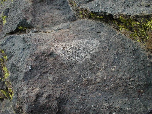
A tell-tale rock, or so 'tis told: some granite included in a mass of grey-black basaltic rocks.
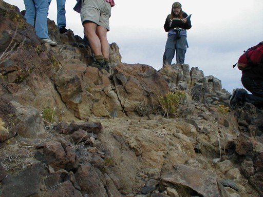
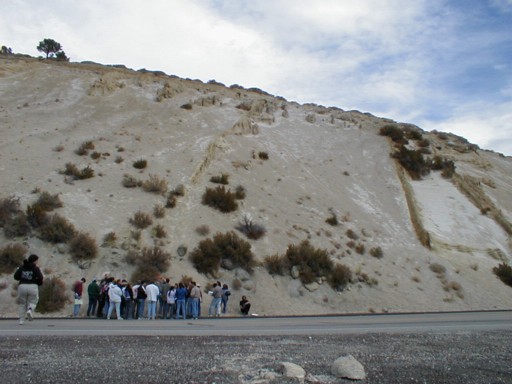
The different colors of the rock upon which everyone is standing corrospond to different rock types: darker basalt, lighter rhyolite, even grey-white granodiorites (which are everywhere near the Sierra Nevada batholith) in the distance.
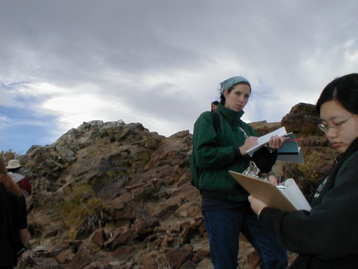
The "peak" (about 30 ft above ground) of Knopf's Knob, with diligent geology students Grace and Maki in foreground.
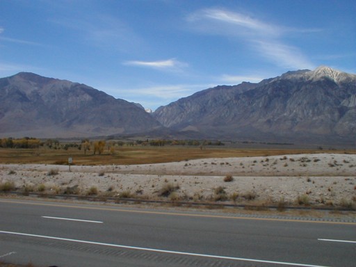
Our next stuff was brief; here is the view on the other side of the road (US 395). The Sierra Nevadas are cut by a V-shaped glacial feature, and in front of that you can just make out the gentle sloped glacial moraines.
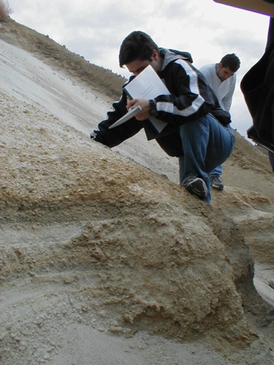
Big Pummice Cut was also right on the side of the road, but we stayed here for quite a while. The hillside has a very steep slope 6 inches or more deep with loose, light, whitish pummice that quickly fills your shoes. Here we see a number of different airfall layers, or multiple layers of volcanic dust and small particles laid down over a few hours or days by the big eruption in the Long Valley Caldera.
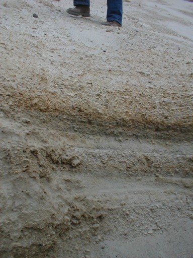
Several places on the slope are raised dykes where gravel or mud flowed down the slope and then hardened, remaining after the rest of the slope had eroded away. The slope, as I said, is very steep; this picture is roughly aligned with the horizontal.

Here is a different raised dyke, with a fair amount of clay in it.
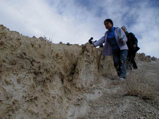
A side view of the same dyke, which is smooth on one side by has these uneven features (of water erosion most likely) on the other side.
A view from across the busy freeway. The airflow deposits above are to the right, just beneath the white patch; the second dyke starts at about center-top and angles leftward. Note how there are more bushes (and also large boulders) on the bottom of the hill angling upward and toward the left at about 30 degrees. This is interpretted as glacial till (unsorted glacial deposits) which was then tilted with respect to the later fall of volcanic material (Bishop tuff pummice as well as the airfall layers).
Note also Maki running across the street, as she just notices that she has dropped her pen in the road. There is a truck barrelling down on her just off picture, but she still bends to pick it up, and takes a looong time of it...
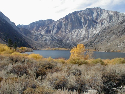
We then ate lunch (mmm... lunch) at Convict lake, while seated upon (what else?) rocks in the near shore area. There are lots of glacial moraines in this area, and if you look at the Sierra Nevadas you can see folds and bends in the rocks that make them up (since there is no snow to obscure it yet). The yellow leaves are pretty too.
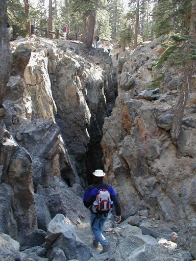
Our next to last stop was the earthquake fault associated with a major event dated by Indian legend to 1799. The fault really is a fissure, and very deep (even after a few hundred years of debris has eroded into it).
Our final spot was at Hot Creek Hot Springs, where we did all sorts of geologic things such as measure the temperature and pH and look at normal rocks made strange by chemical reactions and avoid a certain menacing-looking geobiologist in a snorkel. Sorry, no pictures.
Last modied 11.11.2001
Return to my home page